In last week’s post, I wrote that the river that had risen to the top of my Hit List during the brooding period this winter was the North Fork of the Pemigewasset, arguably the longest stretch of whitewater in New England that nobody ever kayaks. Why? Because you can’t get into your boat until you’ve lugged it four miles uphill. A four mile hike will keep most of us away.
Let me rephrase that. A four-mile hike with a kayak will keep most of us away. Even though we as a nation are growing more obese with every flavor-packed snack produced (after all, what can you really do when someone engineers something as diabolical as Trader Joe’s bacon-flavored popcorn?) — still, there are whole parking lots full of paranormally dedicated hikers here in New England who will not only think nothing of hiking four miles uphill, but they’ll want to do it during a blizzard, while it’s pitch dark, wearing shoes made entirely of hemp. Take the “grid” movement for instance, New England hiking’s latest fad. Completing a grid involves hiking each one of New Hampshire’s forty-eight 4,000 foot mountains during every month of the year. That means you have to hike 18 miles out to Bondcliff in December. And then in January. And in February. It’s crazy. No wonder the moniker “gridiots.”
So you can see that a four-mile hike — even one that goes 1,500 feet up the formidable Ethan Pond Trail in the White Mountains — does not exactly raise a lot of eyebrows around here.
But that’s if you’re carrying reasonable stuff. Those gridiots are not only reasonable, they’re weight fanatics. They have whole stove systems that weigh less than a toupee. If you’re a regular Joe carrying nothing more than a turkey sandwich, a map, and some of that Trader Joe’s bacon popcorn that you don’t even really like anymore but haven’t been able to stop eating for four years, then you’re probably fine with a four mile hike. But strap a 45-pound Prijon Pure XL on your back? Just staggering to the end of the parking lot will probably take twenty minutes. If you want to kayak the North Fork of the Pemi, you’ve got to earn it.
I would know. I’ve carried my kayak into lots of dumb places. Probably the dumbest was back in 2010, when I actually carried my kayak eight miles into the Grand Canyon. Let’s just say I got a lot of funny looks from German and Japanese tourists. I almost spooked a mule team into accidentally taking their riders right over the edge of a 1,000 foot cliff.

But other than the fact that it was about 110 degrees out and I was in the kind of terrible shape only a grad student can be in — that was actually pretty easy. I was going downhill AND I was carrying a fiberglass boat that weighed about as much as a box of Lucky Charms.
Some friends and I had a much harder time a few years ago when we actually decided to run the lower section of the North Fork of the Pemi (down on the part where it becomes the East Branch of the Pemi). We decided to carry our plastic creek boats three miles upstream from our normal put in to the confluence of Franconia Brook. Understand — all three of us were in our twenties and in good shape. Plus, the Lincoln Woods trail is about as steep and rocky as your average basketball court. And we were dragging.
Allow me to compare myself to Lance Armstrong for a moment.
There’s a particularly great anecdote about how far cancer wounded Lance in his book It’s Not About the Bike. (It’s kind of a strange book in hindsight, considering that he was doping the whole time, and lying about it. Maybe the sequel to It’s Not About the Bike should be called It Was Actually About the Human Growth Hormone.) In the anecdote, Lance writes about finally taking his first ride after recovering from cancer. Not bike race — bike ride. Feeling confident as always, Lance finally prevails on his doctors to let him ride, and hops on his bike for his dramatic first lap around the neighborhood. It’s going well, he’s a little tired, but pretty confident he’ll be back in the Tour de France in no time. Then someone goes whizzing past him. Just shoots right by him like he’s standing still. Lance looks up. It’s an old woman with grey hair. She’s riding an old rec bike. It wasn’t until that moment that Lance realized just how much chemotherapy had weakened him — and how far he had to go before he’d race again. It was a wake up call.
Fast forward to 2012. I think that same woman — twenty years older — shot past us on the trail while carrying her oxygen tank. We were the biggest guys on the trail, but we were dying while carrying those boats. Moms in sensible shoes, Depression-era men with canes, pre-teens with ears full of Justin Bieber — everyone was dropping us. It was so bad that I went home that night and began injecting myself with human growth hormone.
Why do I mention all this? Because that’s why nobody hikes the Appalachian Trail with a kayak into Ethan Pond to run the North Fork of the Pemigewasset. Hiking with a kayak is hard. As far as I know, nobody’s run this river in about five years. Which is of course what drew me here in the first place.
But before I was going to make that hike beneath the weight of a Prijon Pure XL, I knew I’d need to hike in there without a boat first — just to make sure this whole idea was a good one. Last week, on April 10th, I woke up on a sunny Sunday morning as excited as possible to see if it was.
The parking lot brought back vague but unpleasant memories. I’d hiked the first mile of this trail the previous summer, before veering off on a precipitous side-trail that leads to the towering summit of the absolutely massive Mt. Willey. If you’ve ever driven through Crawford Notch, you’ve seen this titanic mass. Mt. Willey is huge. And — climbed from this side, which is uncommon — it’s one of the most secretly ass-kicking hikes in New Hampshire. The kind of hike where you try not to keep looking at your phone — because it’s just going to say that in the past thirty minutes you’ve done exactly .0046 miles. There is no way I would ever carry my kayak up Mt. Willey. Not even if I’d been hanging out at Balco with Lance, Barry Bonds, and Mark McGwire.
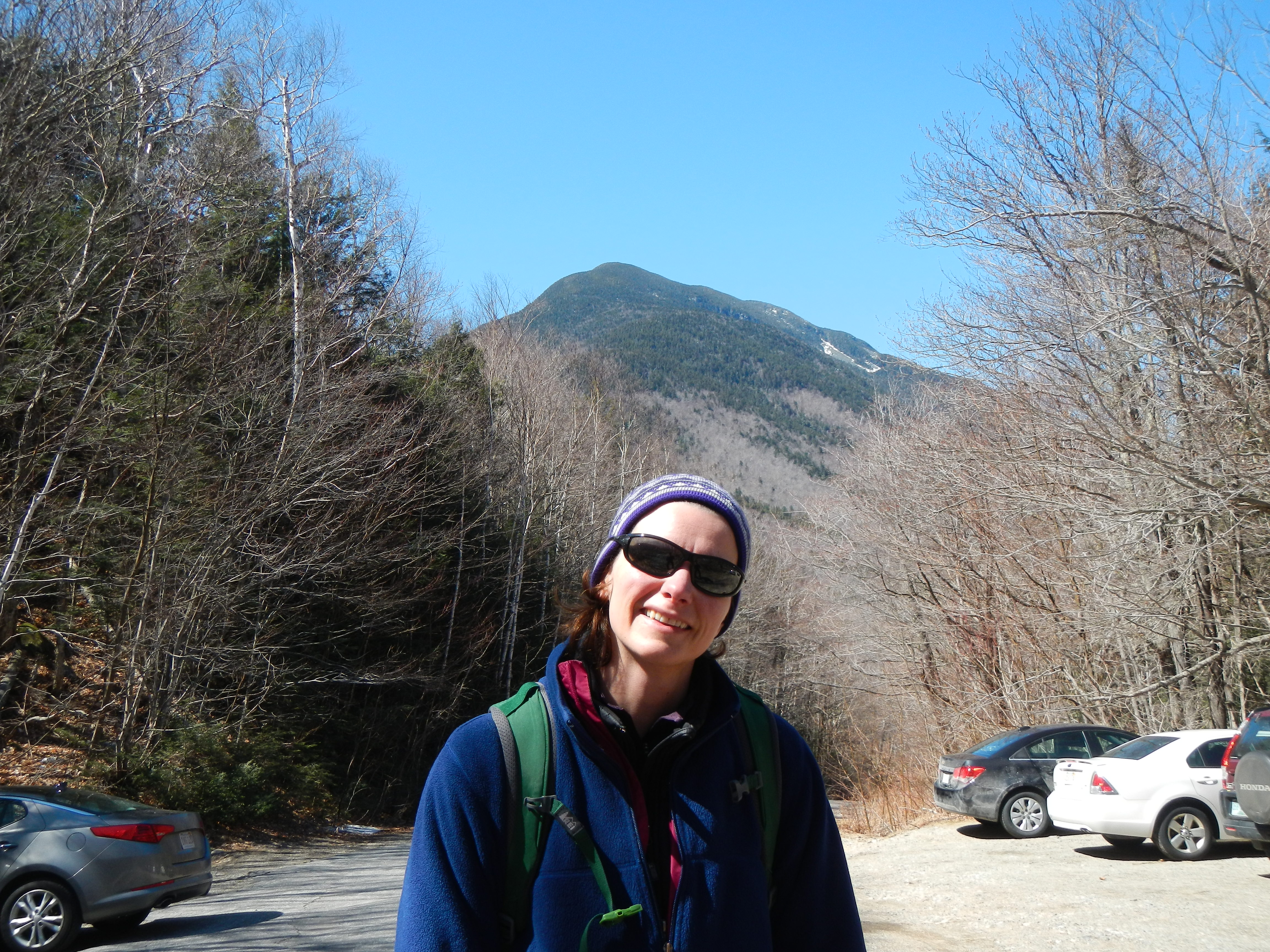
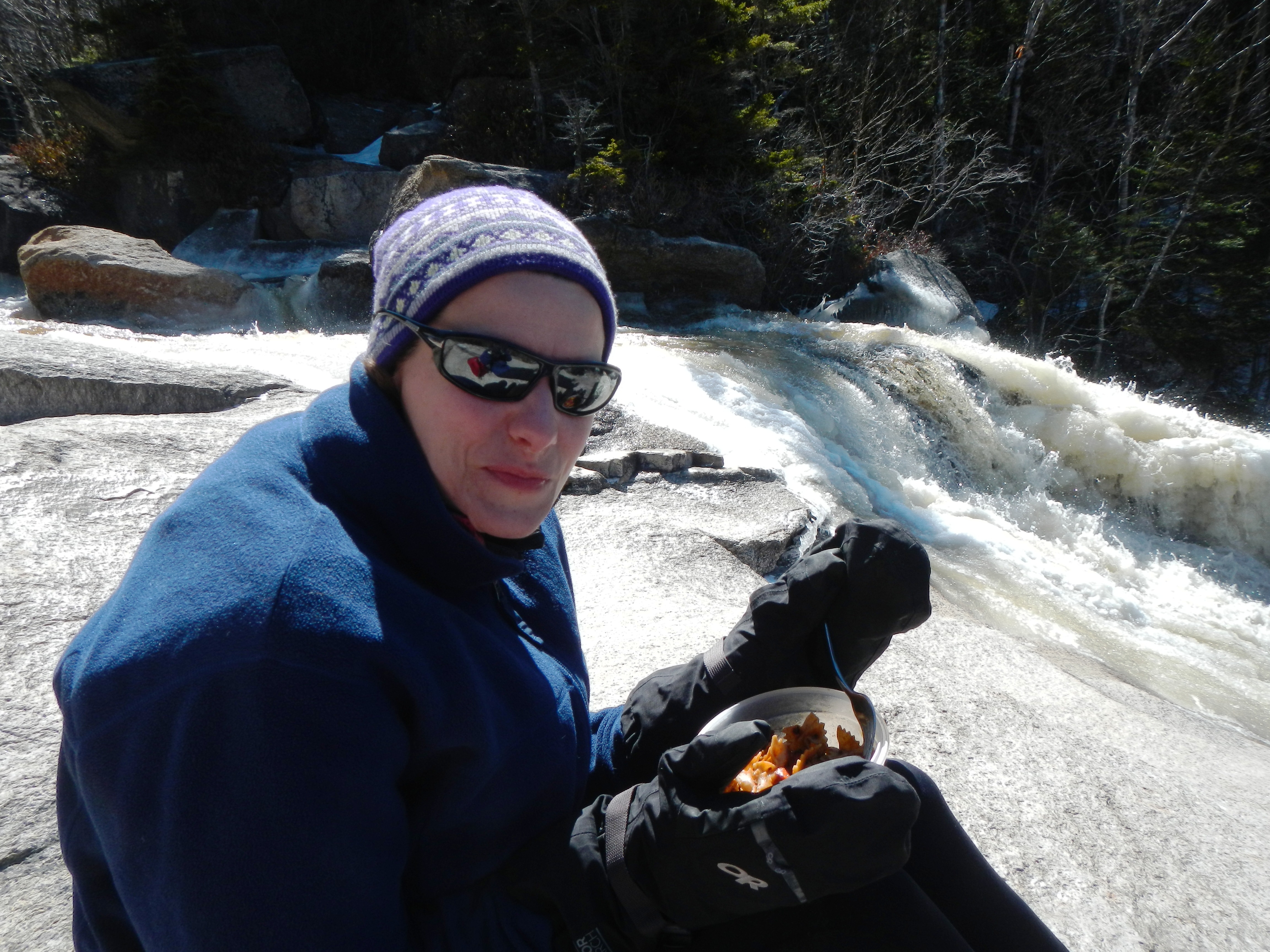
The first, steepest mile of the hike went easily. All I was carrying was a lunch, a map, and — as is my wont — enough extra gear to clothe a peewee hockey team. For some reason, even though I tend to spend most of even the coldest hikes in just a t-shirt, I tend to pack like a Boy Scout den mother. As you can see from the following photo, it’s certainly not from a need to look stylish. But on this day the extra clothes would come in handy.
Ethan Pond, this trail’s basic end point, is not exactly a marquee destination. But by now nothing the New England hiking community chooses to do surprises me. So it was with very little disbelief that I watched as three men passed on on their way down from spending the night at the Ethan Pond lean-to (a desolate affair with about two feet of snow drifting up the front step, inside), and later when six or seven women passed us on their way up to do the same as we hiked down. I checked to see if their shoes were made of hemp, but I couldn’t tell.
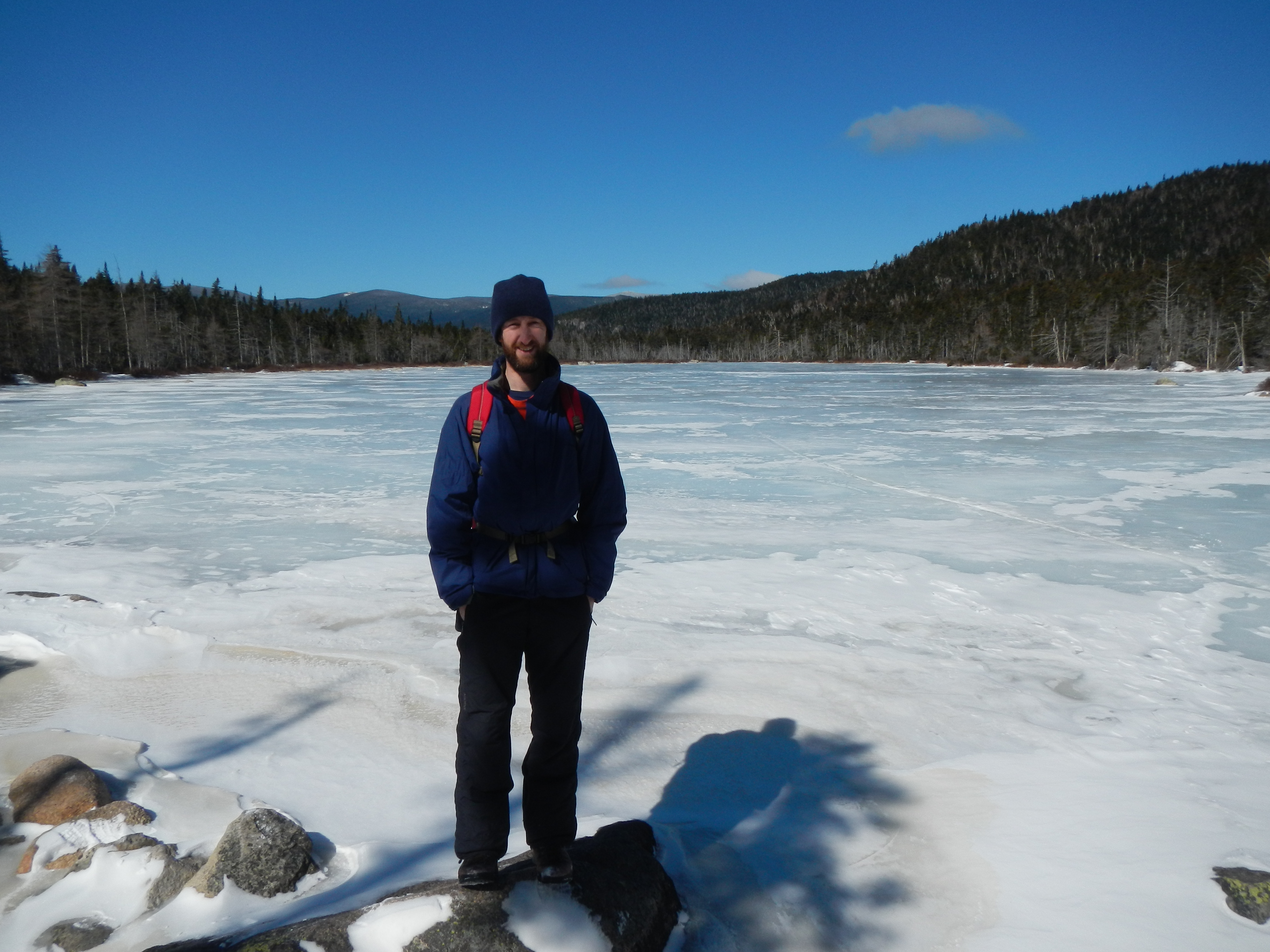
What did surprise me was how cold it was once we arrived on the plateau at the top of the river drainage behind Mt. Willey. I thought for sure it would be windless, but instead it was raging and bitterly cold. I’d been down to my normal t-shirt by the time we’d done our elevation, but I quickly whisked about four shirts out of my bag by the time we paused to take a photo across a completely frozen Ethan Pond. The sense of isolation was wonderful.
After forgetting my microspikes and having to waste an hour driving home to get them the week before (and inspiring my fiancee to start a new relationship meme, best described as her miming a “time to remove the engagement ring” motion with an accompanying “removal” sound effect [“shhooooop!”]) I threw my spikes in the pack basically in atonement for last week’s boneheadedness. I wasn’t expecting to need them.
I was glad I did! Not only did we need them, we used them almost the whole way. Although there was no snow at all down low, lurking just up above the parking lot was first ice, then snow, then a lot of snow: at least a foot and a half. Fortunately it was all frozen solid — otherwise we’d have been postholing like the moose who’d been through a few days before, and whose hoof prints let us see just how far down the ground was.
Although it was incredibly clear, it was also really cold — at least twenty degrees colder, it seemed, than when we’d started at the car. As we got deeper and deeper into the wilderness, my fiancee started getting really cold. As we were hiking a remote section of the Appalachian Trail, getting deeper and deeper into the woods and not seeing anyone else’s tracks on the trail ahead of us, I decided it was probably best to turn around. But first I made a beeline to the river through the woods. At least I’d have glimpsed what exciting rapids there were up high on the North Fork.
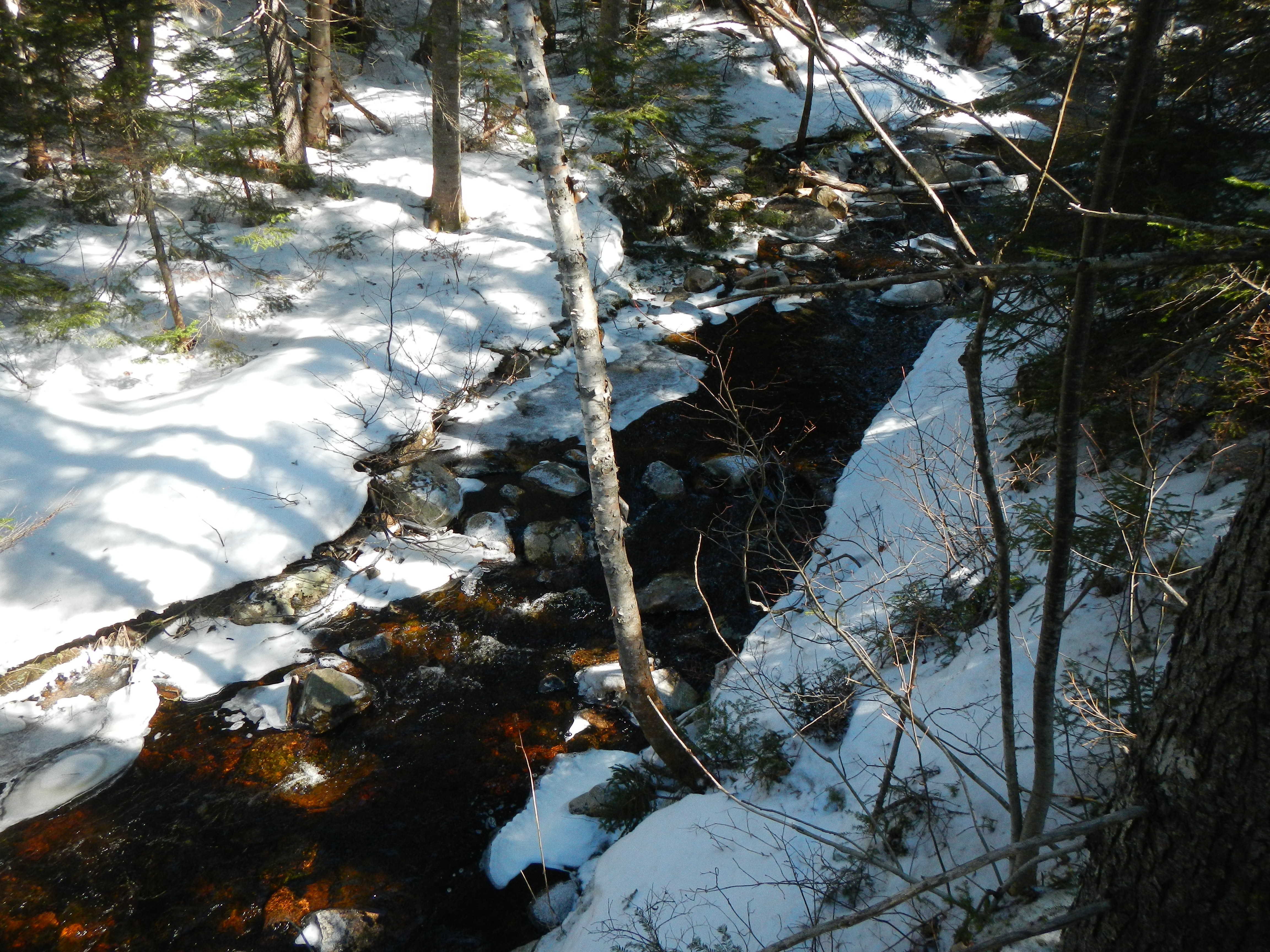
Was I disappointed. Even a half-mile downstream of the pond, it wasn’t much more than your basic Washington, D.C.-area micro creek (minus the hypodermic needles and the giardia component). Certainly not boatable.
Back at the trail, my fiancee, despite being cold, did not want to turn around. Instead, I began fishing more and more extra gear from my giant pack and applying it to her, layer by layer: an extra jacket here, two pairs of mittens there, even a sweater as an improvised face-mask. As we continued on the trail, I began thinking about some friends of mine who were likely the last people to kayak the North Fork, back in 2011, and who’d spent hours postholing through this very same section of trail on their way to spending an unplanned night at the Zealand hut. Looking down at the moose prints going far into the snow, I couldn’t imagine how frustrating that must have been. On this day, on top of the frozen snow, we made quick work of the flat trail.
And then — about a half-mile before the Shoal Pond Trail junction, the river swung back into view. And this time, having picked up the innumerable side-streams we’d been stepping over for the last mile, it was a different riverbed altogether. The first thing we saw was a beautiful low-angle bedrock slide that looked like something off of the Upper Pemi.
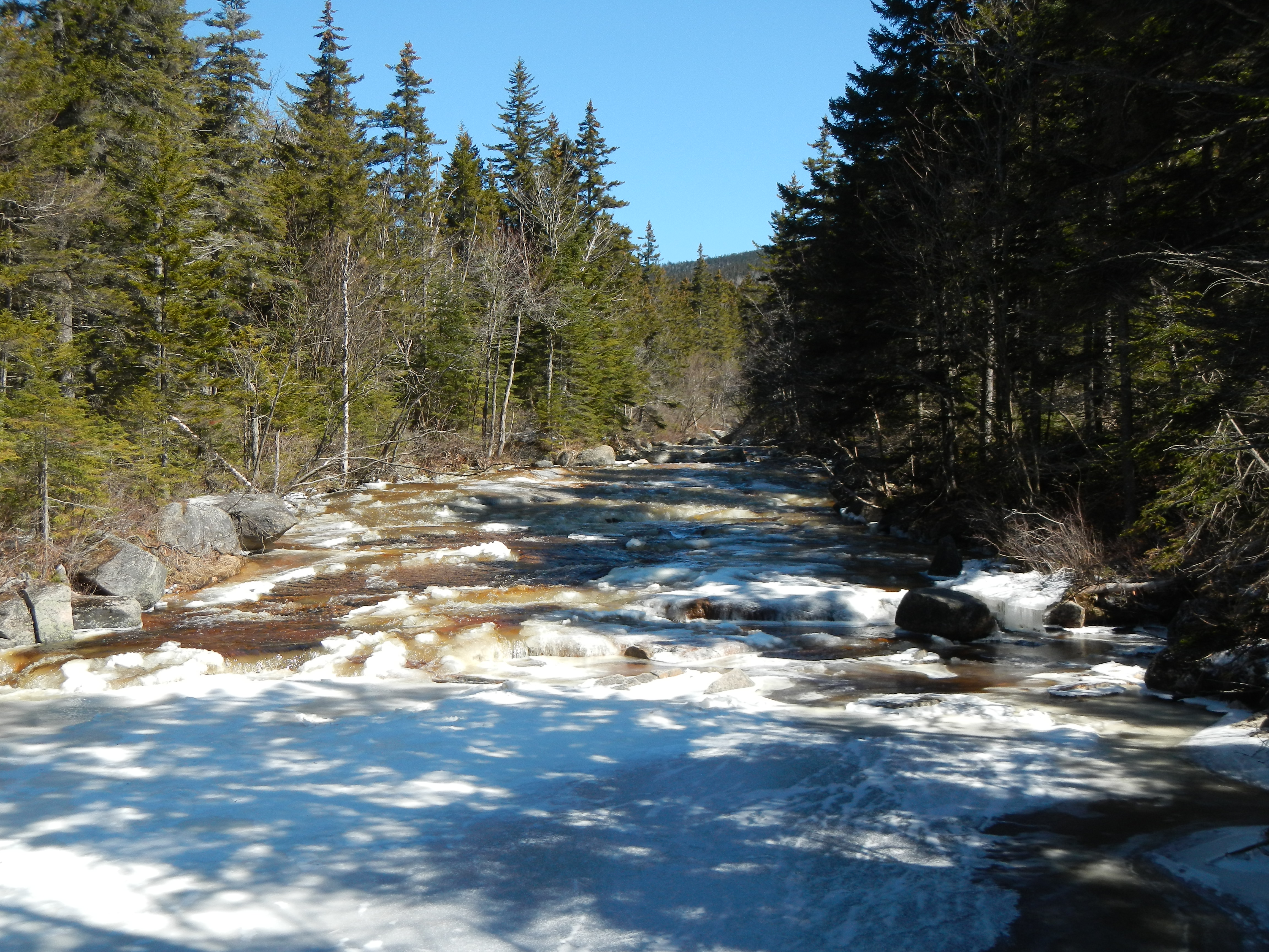
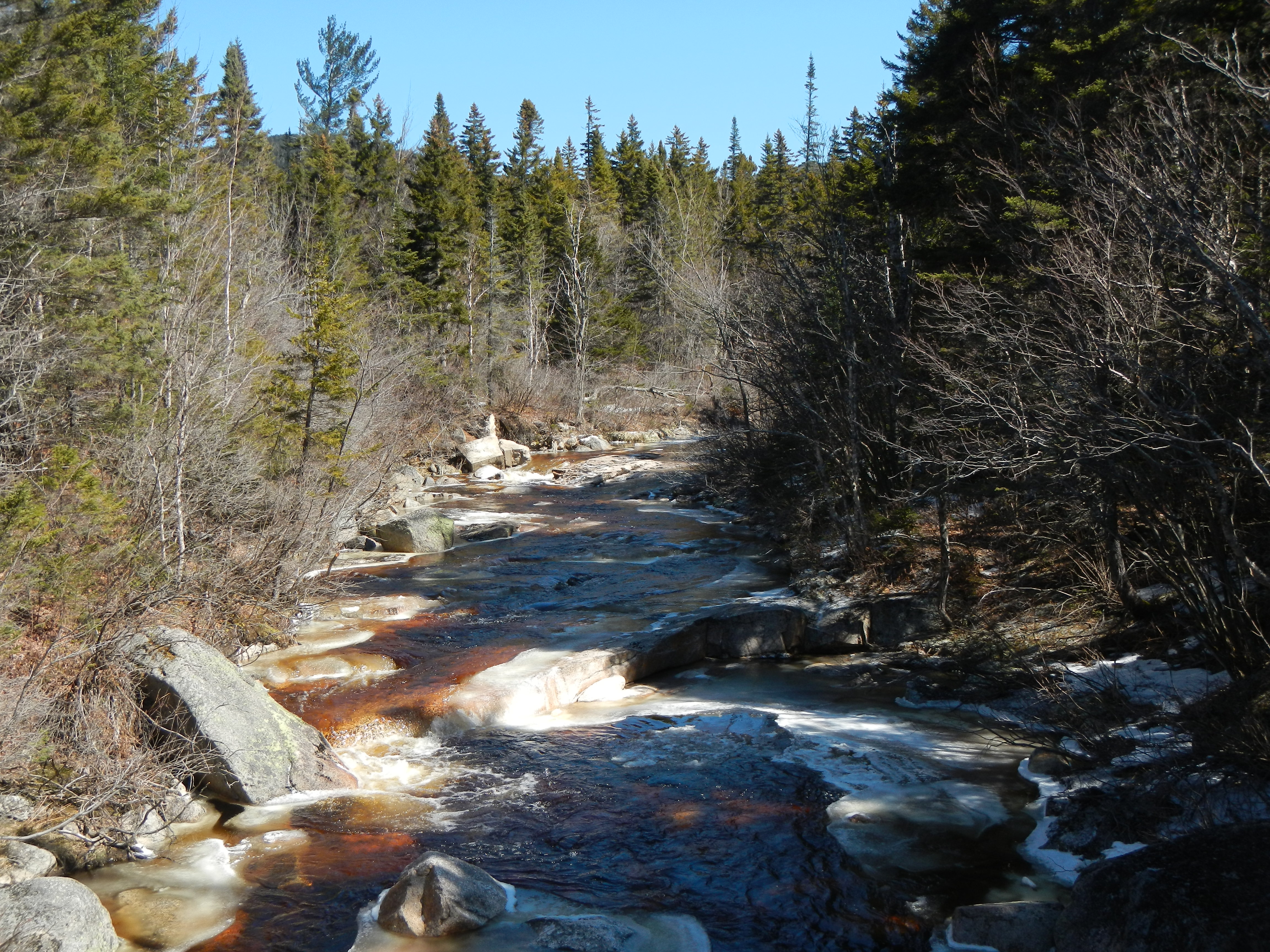
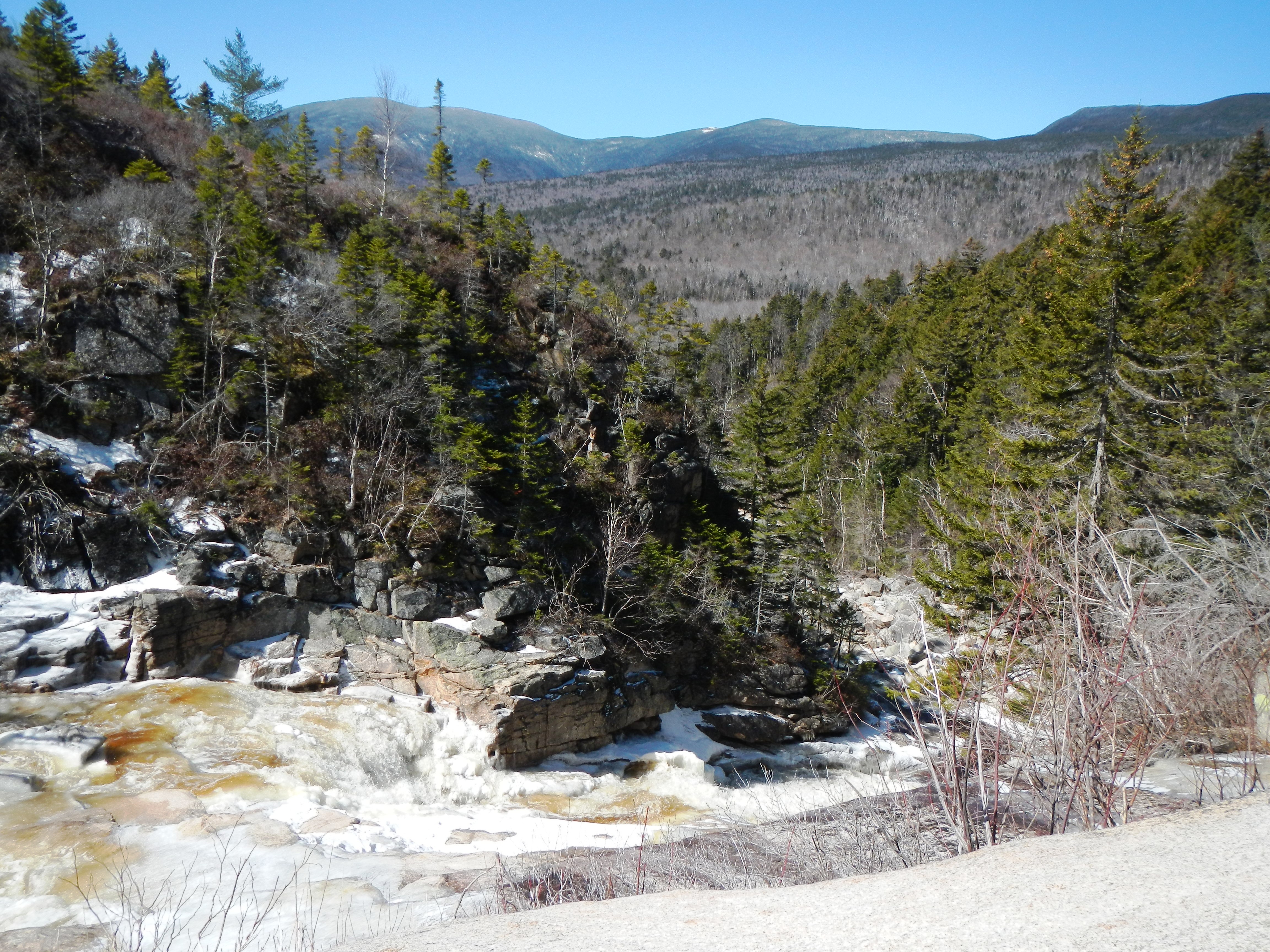
Thoreau Falls was our ultimate destination on this day, and it lived up to the hype. It was HUGE — far bigger than I’d expected. What’s more, we had it all to ourselves, and it was so far out there, we felt like we’d really earned it. Just being there alongside one of New Hampshire’s most remote waterfalls made the whole hike through the cold more than worth it.
The trip back home was easy and quick. Maybe it was the weather, or maybe it was the downhill, or maybe it was psychological, but the temperature on the way back seemed to rise, and we were back at the pond, then back at the trail junction, then back at the car in what seemed like no time at all.
Overall, I came out of this adventure just as excited — if not more excited — than I was before about hiking in to kayak the North Fork of the Pemi this spring. Not only does it look like a feasible riverbed, it looks like a fun riverbed. The rapids above Thoreau Falls look interesting and manageable. And while Thoreau Falls is a sure portage, I could see several big, tough rapids just below the falls that look like they’d be a lot of fun to run or scout depending on the water level. At a basic level, just being out there on a river trip would be a lot of fun. It’s hard to imagine running a river as long as the Taureau, with no houses or signs of man, from all the way out there at Ethan Pond to somehow ending up at Lincoln Woods. I mean, I know that would happen if I got in my boat — I’d end up down near Loon — but it’s pretty hard to picture because I’m used to having to drive two hours by car just to connect those two places. Something I know to see in its entirety for myself, for sure.
Water levels will be tricky, I’m sure. You need a lot of water up there, clearly, but not so much that you’re just portaging from Ethan Pond to the Whitewall confluence. And I don’t see us having enough water in the river any time soon during this temperamental spring we’re having. While there was still a lot of snow in the headwaters, that doesn’t necessarily translate to runnable levels. Yesterday, April 17th, temperatures in New Hampshire rose to 72 degrees, and the Pemi’s water level didn’t budge. Not to mention that I’m not about to hike in there anytime soon and risk postholing. Even with snowshoes, I still don’t think it’s wise to go up in there until at least most of the snow is melted. That’s probably not going to happen this week, my vacation week. So it could be a while.
I also think that, while I certainly want to ultimately paddle the Pemi from Ethan Pond, I may run it the first time from the other access point, from the Zealand Road, especially once the road opens. My philosophy with new trips or hard trips is always incremental: always bite off less than you can chew the first time, and then go back and taking bigger bites the next.
It may be that I’ll run the North Fork from Zealand and then feel satisfied and not wish to run it from Ethan Pond. I don’t know. My guess is — I doubt it. But we’ll see. Maybe time and weather will conspire to make me feel as though paddling from the very top the first time is the best option after all. I’m not worried about it either way.
What I know is this: the North Fork the Pemi is still highest on my hit list. It’s fun to have a project that combines a few of your interests. For me in this case, the trip combines my love of kayaking (especially for kayaking entire river stretches), my love of hiking, my passion for exploring one of the great wilderness areas of New Hampshire, and perhaps my love of camping. I don’t think there’s anything better to me right now than the idea of exploring the whole Pemi Wilderness by boat. Because a boat isn’t just a means to run exciting rapids, it’s a tool for exploring places you couldn’t otherwise see. I hope this spring holds enough rain and enough warm temperatures that I’m able to get that chance.
I know that our hiking trip up there was a great first step. I can’t wait to go back.
Happy Spring.