The other day as I was happily cruising down a deserted side street, bypassing the tourist-clogged main artery of North Conway, New Hampshire, it occurred to me that I might have finally earned the right to call myself a local here in the White Mountains. And it’s not just traffic short cuts that I’ve discovered; over the past two years I’ve stumbled on the best places to eat, the best places to drink, the best place to get cider donuts, and most importantly, the best places to hike.
The White Mountains have some of the top hiking in New England. I’m fortunate to have much of it right outside my front door. Remember that SNL skit when Tina Fey did a dead-on impression of a loopy Sarah Palin? She explained her foreign policy “credentials” like this: “I can see Russia from my house.” Well, on a clear day, I can see the East Coast’s finest hike from mine.
What are New Hampshire’s best hikes? Allow a local to answer.
Mount Willard
New Hampshire’s Shortest “Big” Hike
(Difficulty: Easy)
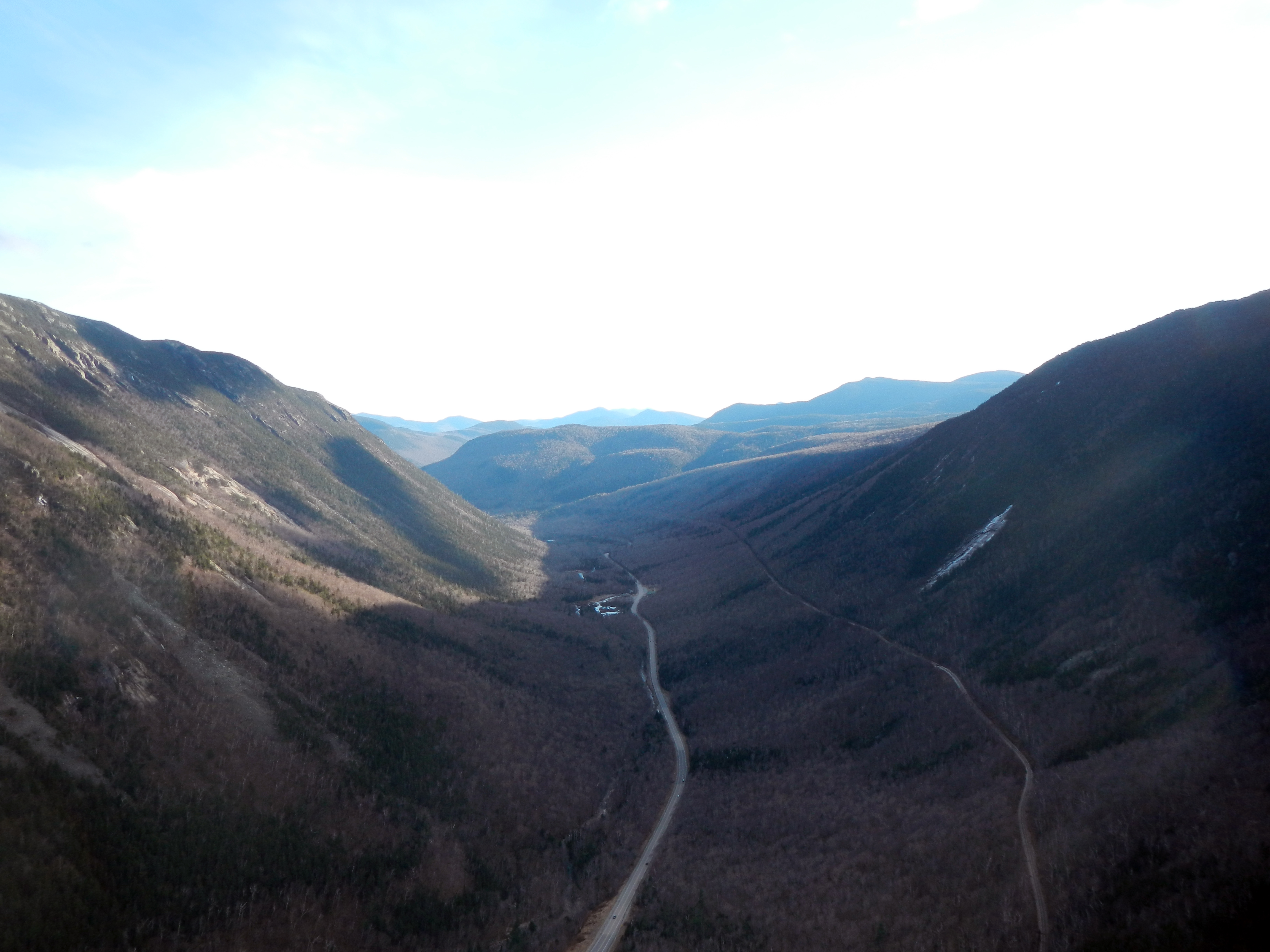
Both short and dramatic, this hike might offer the most bang-for-your-buck in the White Mountains. The summit is a dramatic viewpoint overlooking Crawford Notch, a giant U-shaped pass that looks like a skate park built by the gods. This hike gets crowded, so make sure to get there early. There is ample parking at the AMC building just off of Route 302.
Lonesome Lake
Short Hike to a Beautiful Lake — But Get There Early
(Difficulty: Easy)

Along with Mt. Willard, this may be the finest short hike in the White Mountains. Right off the highway in Franconia Notch, the Lonesome Lake Trail is just the right pitch and length for a good workout before you emerge at Lonesome Lake itself. Walk around the lake to the AMC Lodge for striking views of the Franconia Ridge. In the winter you can walk straight across the lake to the lodge.
Local’s Tip: Get here early, especially on a weekend. Parking at the trailhead is limited, and you may end up parking on the shoulder of I-93: not an enviable start to your hike!
The Moats
Low Elevation, Stunning Views, Right Near Town
(Difficulty: Moderate)
It wasn’t until just this spring that I finally climbed the Moats. Why? They’re not tall. At right around 3,000 feet the three Moats (North, South, and Middle) are small by New Hampshire standards. But what they lack in height. they more than compensate for with interesting, open approaches, proximity to North Conway (which the Moats tower almost directly over), and panoramic summit views unobstructed by other mountains — views that sometimes stretch all the way to the Atlantic Ocean.
You can hike all three Moats in one long day, or pick off one at a time. South Moat by itself is a wonderful, medium-length hike, while the popular North Moat loop ascends the open, view-lined Red Ridge Trail.
Local’s Tip: Make sure to hit Moat Mountain Tavern in North Conway on your way home for a beer and burger.
Mount Washington’s Alpine Garden
Alpine Flowers on New England’s Highest Peak
(Difficulty: Challenging)

In late May and June, hike up to the Alpine Garden just below the summit of Mt. Washington, to see rare and beautiful alpine flowers in bloom. Oh, and the hike up’s not bad either. I like to take the Tuckerman Ravine Trail to the Lion Head Trail, which gives you a spectacular look down into the Ravine. It’s not an easy hike by any means, but the colorful flora — and the magnificent view from New England’s highest peak — make this an early summer hike not to be missed.
The Alpine Garden is located above treeline on the most famously unpredictable mountain in New England. Be sure to check the weather ahead of time and to be prepared for rapid swings in temperature.
Of course you can drive up the Auto Road (cost: $29 + $9 per adult, $7 per child) and walk down to see the Alpine Garden. But where’s the fun in that?
Local’s Tip: The best time to experience peak bloom is usually early June.
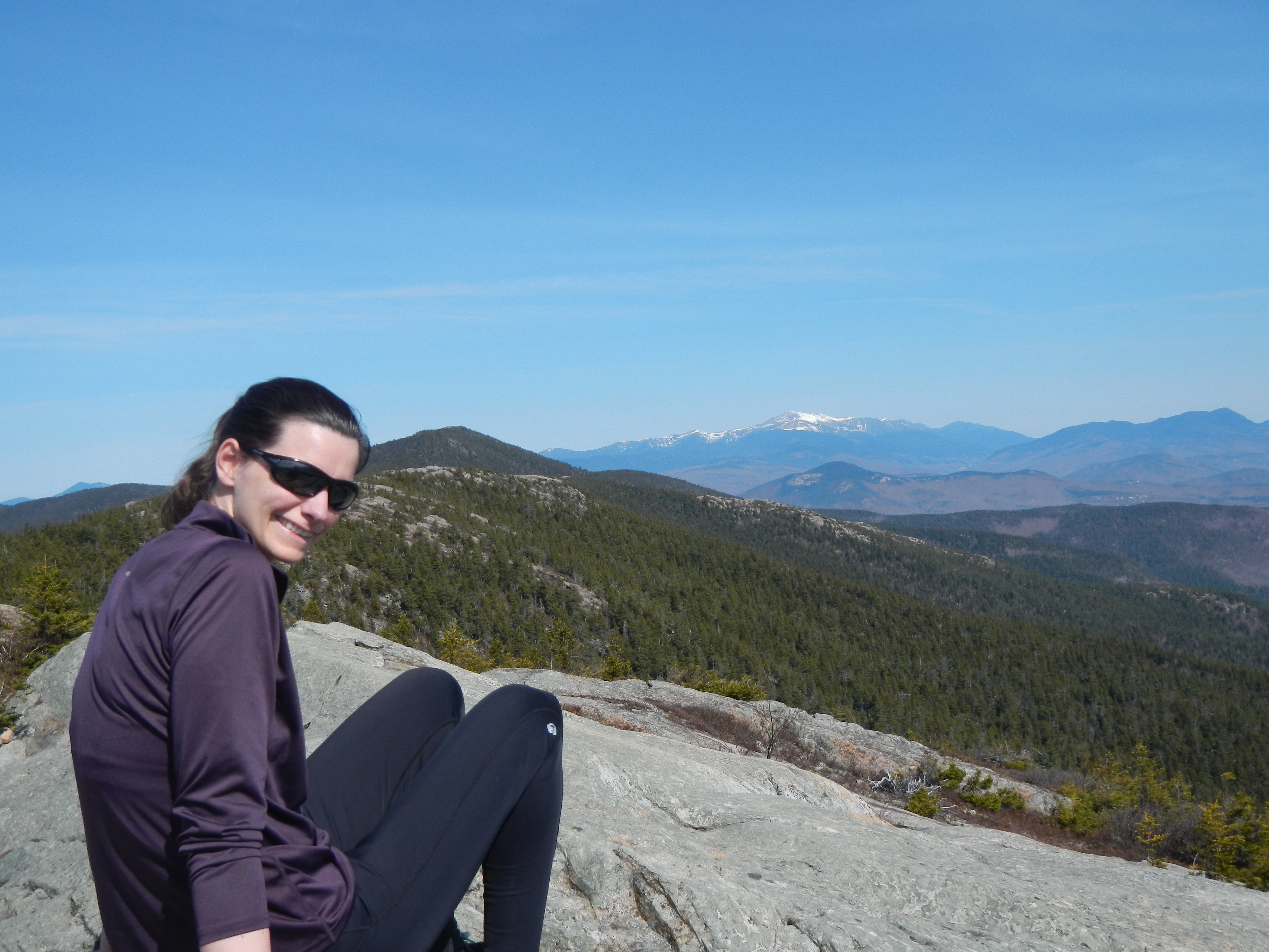
The Kinsmans
New Hampshire’s Most Overlooked Ridgeline
(Difficulty: Challenging)
The Kinsmans. If you drive in from the south, they don’t look like much. But if you drive in from Vermont on I-93, the Kinsmans are the first White Mountains you see. Rising straight from the valley in Easton, they’re imposing. That side — the west — is the side I recommend hiking them from.
While the Kinsmans are hikeable from both sides of the ridge, hiking from the Easton side means you’ll deal with far less hiker traffic and much easier parking than if you start from the more popular Franconia Notch.
Starting from Easton also allows you a short side hike out to the Bald Peak on the way up: a worthy peak in its own right.
But the Kinsmans are the main destination. The 360 degree panorama from South Kinsman and the balcony ledge on North Kinsman both feature outstanding views of the nearby Franconia Ridge and Cannon Mountain. Make sure to hike down to Kinsman Pond, which, perched almost directly below North Kinsman is one of New Hampshire’s highest lakes, as well as the home of a great campsite.
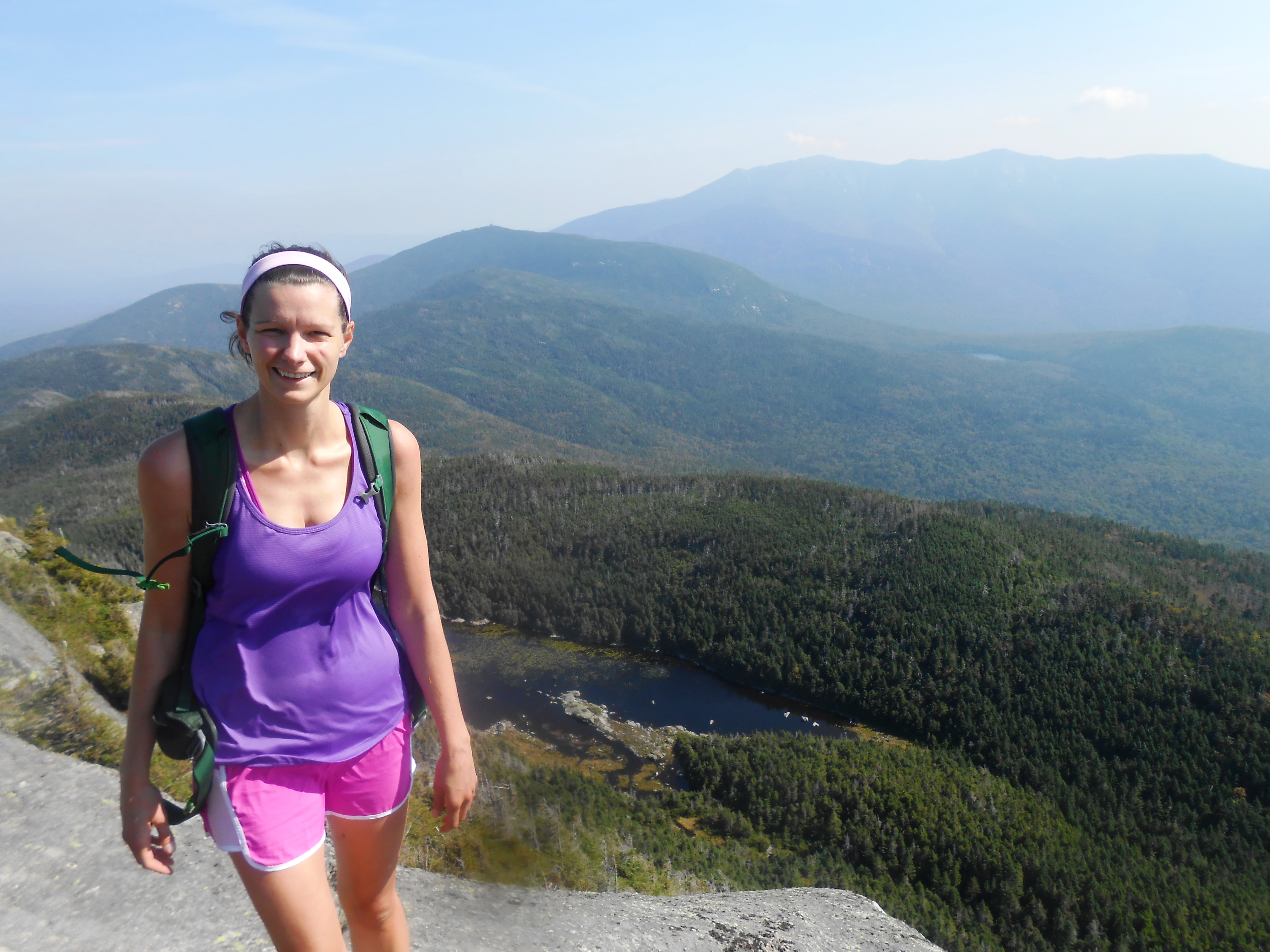
Mount Moosilauke
A True New England Classic
(Difficulty: Moderate)
If you hike in New Hampshire, you have to hike New Hampshire’s most giant land mass. Mount Moosilauke is a huge piece of earth. The best way to do it is to hike up the Gorge Brook Trail to the broad, meadow-like summit. Views are sweeping in all directions.
One of my rules of hiking is, “This is the East. When faced with hiking above treeline or hiking in the trees, for God’s sake hike above treeline for as long as possible.” That’s why I like walking from the summit of Moosilauke downhill along the Appalachian Trail to the South Peak. You’ll be above treeline almost the whole way and you’ll get to drink in the scenery. Then, take the Carriage Road to the Snapper Brook trail to complete the loop.
Just don’t leave your GoPro camera on the roof of your car and drive away like I did once.
Thoreau Falls
New Hampshire’s Most Remote Waterfall
(Difficulty: Moderate)
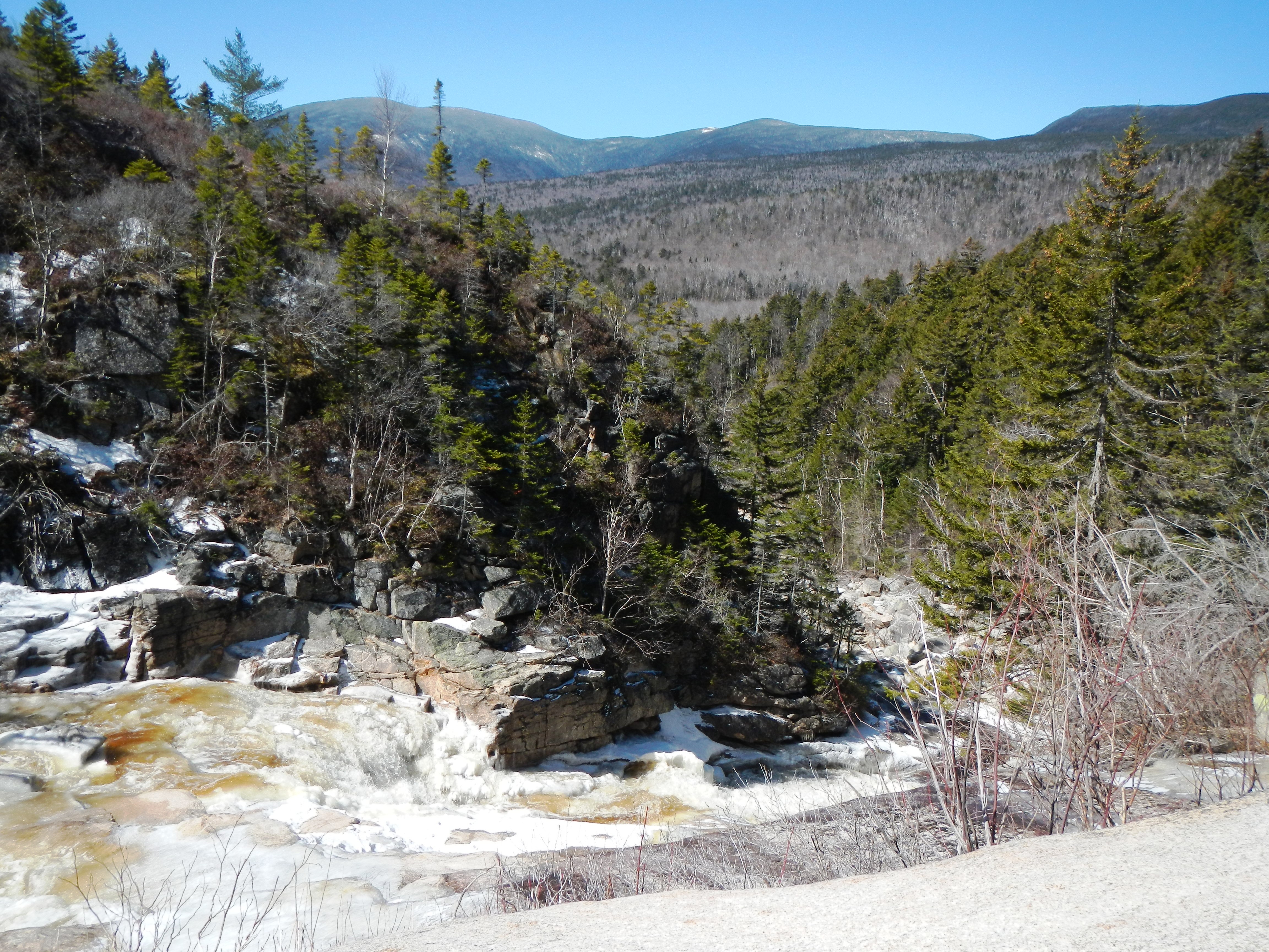
Most of the big waterfalls in New Hampshire — Sabbaday Falls, Glen Ellis Falls, Arethusa Falls — are either roadside or a short hike from the road. While I highly recommend seeing all of those waterfalls, I think the best destination waterfall in New Hampshire is Thoreau Falls, located straight out in the heart of the Pemigewasset Wilderness — at least five miles from the nearest road.
I’ve written about Thoreau Falls several times this spring already. For one thing, the waterfall itself — hard to capture in pictures because of its sheer length — is just breathtaking in person. Not only that, but it’s an interesting, scenic hike just to get out to Thoreau Falls. Hike in either from Ethan Pond or from the Zealand Road. Nothing prepares you for the first sight of this powerful waterfall so far out in the wilderness.
The Bonds
New Hampshire’s Finest Overnight Trip
(Difficulty: Challenging)
This is the premier one-night backpacking trip in the White Mountains. My motto is: “Bondcliff for dinner, West Bond for sunset.” Here’s what you do. You get to Guyot campsite in early evening and set up camp. (How you get there is up to you. I think the approach hike from Zealand is more interesting than the one from Lincoln Woods, but they’re roughly equidistant.) Then you take your day pack and hike down to Bondcliff to have dinner. Chances are you’ll have New Hampshire’s most iconic summit all to yourself in magic light. Then you head back toward camp. Along the way you do a side hike out to perhaps the most isolated summit in the White Mountains. The peak of West Bond is surprisingly small and intimate, with 360 degree views. There’s no better place to take in the sunset in the White Mountains.
And really there’s no better end to a summer evening in the Whites.
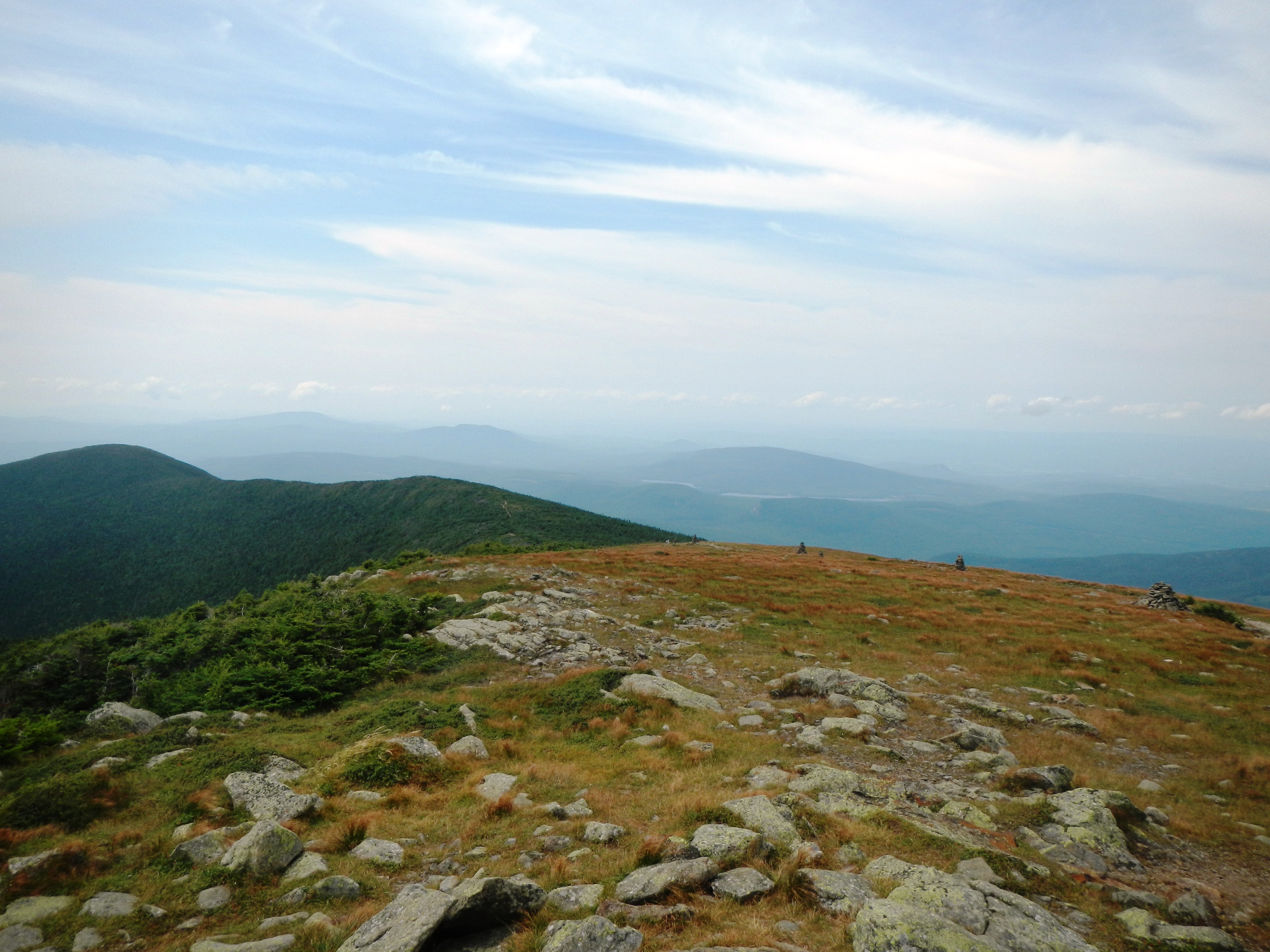
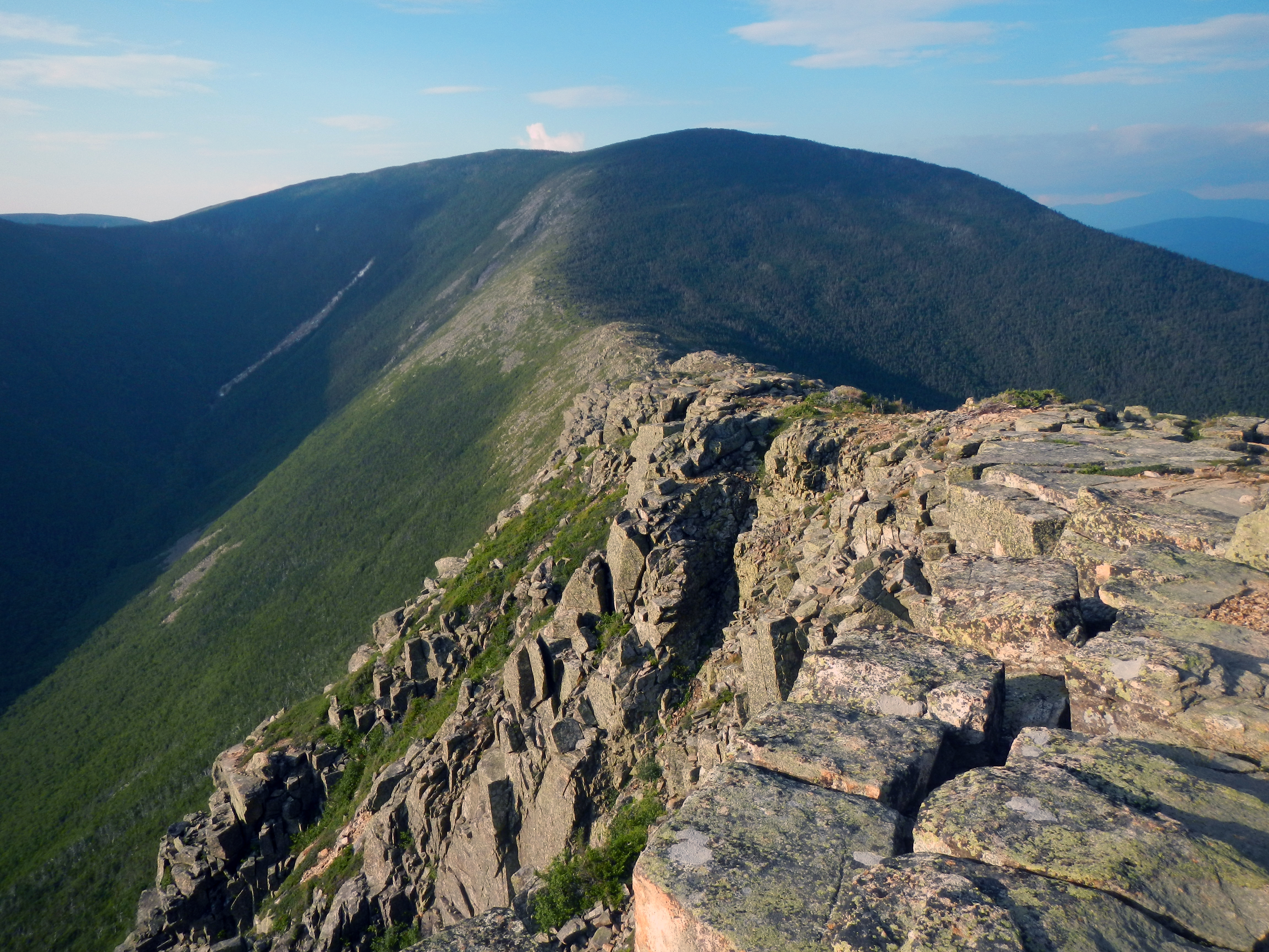
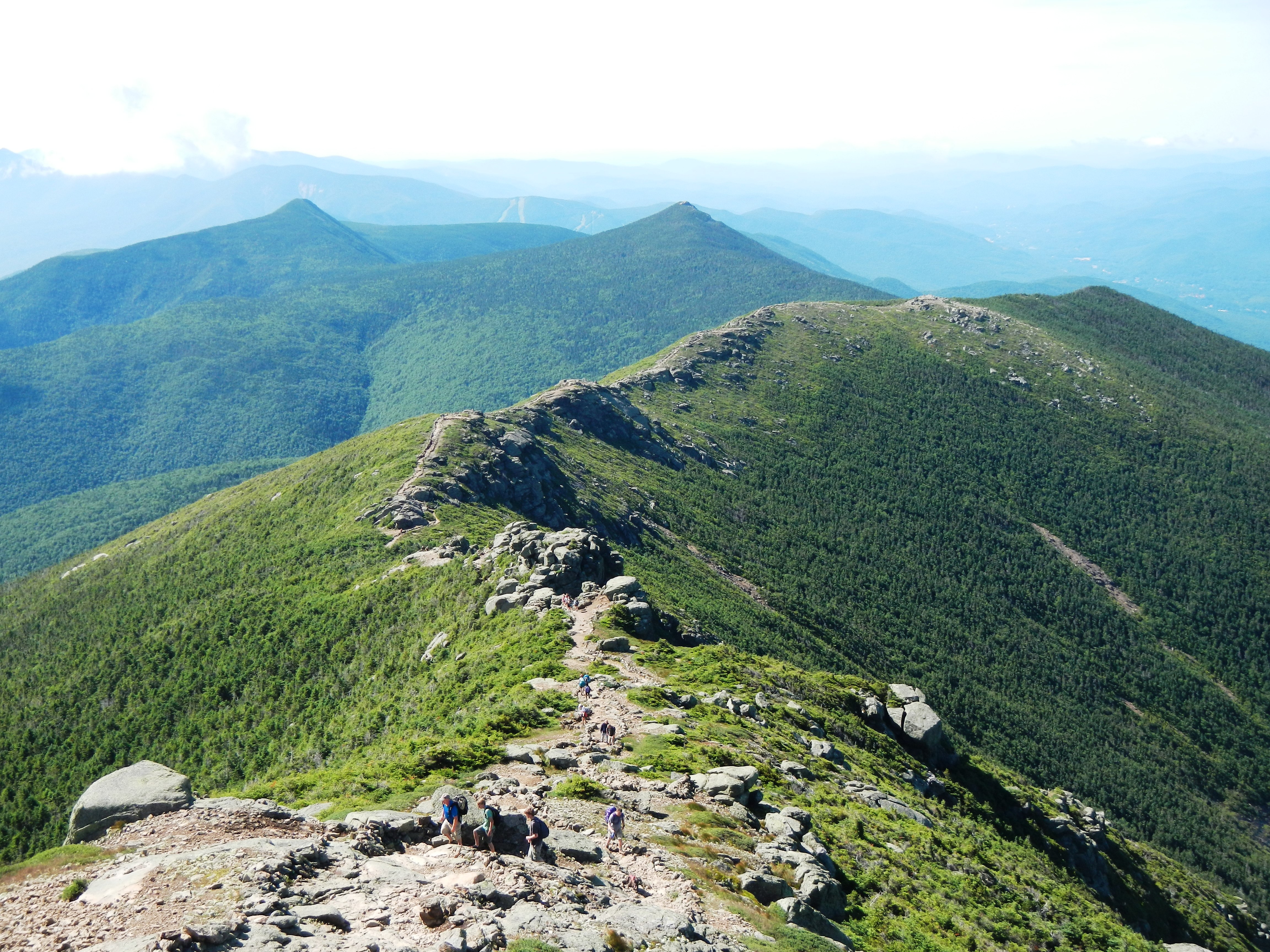
Franconia Ridge
The East Coast’s Finest Hike
(Difficulty: Challenging)
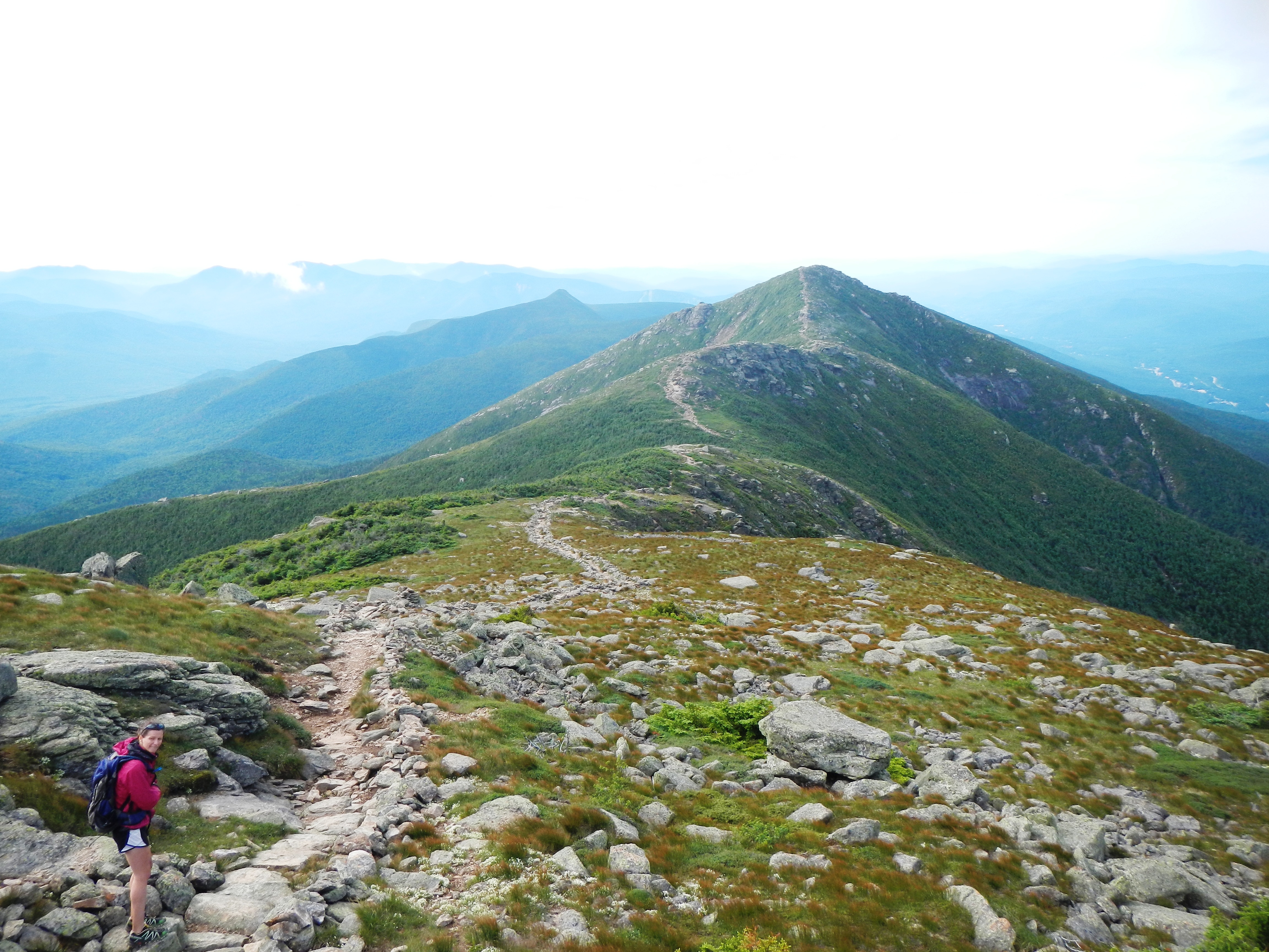
Hands down the finest hike in the East. Although not as daunting as the Presidentials, the Franconia Ridge — Mt. Lafayette, Mt. Lincoln, and Little Haystack — is more spectacular. This blade-like ridge walk soars high above the treeline and features some of the most memorable vistas east of the Rockies. I want to do this hike at least once a year until I die. It’s that good.
Local’s Tip: This is a loop hike. Do it clockwise (Old Bridle Path up, Falling Waters Trail down). Here’s why:
1) Once you get to the ridge, you’ll be able to hike the ridge in a slightly downhill direction.
2) You’ll get tremendous views on the Old Bridle Path on the way up. You’ll need the motivation as you lug yourself up Agony Ridge.
3) People who hike counter-clockwise (most people, I believe) tend to spend a lot of time wondering if they’re anywhere near the top. The reason is that the Falling Waters Trail has no mountain views on the way up to check your progress. (Whereas the Old Bridle Path has many.)
No matter which way you go, the Franconia Ridge is a hike you won’t soon forget.
Resources
There are many good hiking resources on the Internet. Here are a few that I, as a local hiker, use frequently:
Mount Washington Higher Summits Forecast — The best indicator of what the weather will be doing in the White Mountains. Although it’s meant to represent the Presidentials, I’ve found it amazingly accurate for the weather you’ll find up high in New Hampshire.
White Mountains Waterproof Trail Map — I bring this map with me on almost any hike I do in New Hampshire. Waterproof, easy to carry, and contains everything — every trail, access point, campsite, and water source. But it’s easy to read and uncluttered at the same time.
The Mountain Wanderer — Located right on main street in the hiker’s mecca of Lincoln, New Hampshire, The Mountain Wanderer is the best store to get hiking guidebooks, maps, and especially White Mountain National Forest parking passes. Owner Steve Smith is extremely knowledgable and friendly. He’s author of a number of New Hampshire hiking guidebooks himself.
Classic Hikes of the White Mountains — Unlike a lot of regions of the US, the hiking in New Hampshire is well documented by a number of good guidebooks. Perhaps because I’ve had it longest, I’m partial to this one, written by Vermonter Jared Gange. This book is small, portable, and filled with accessible, useful information and maps.