“It’s an Asheville winter.”
That’s what my fiancee and I have been telling each other this December. Usually during the week after Christmas we retreat to the warm temperatures of Asheville, North Carolina to hike the Great Smoky Mountains. This year we don’t need to: Christmas temperatures in the 50s here in the North Country of New Hampshire felt more like the Smokies than the White Mountains. So far, the winter of 2015-2016 has been the warmest and the least snowy I can remember. Normally I ski a lot during my birth month, but this December I’ve skied just once. Although most of the resorts are managing to stay open, the trails at Wildcat, Waterville Valley, and Cannon are mostly grass.
In lieu of skiing, I’ve taken advantage of the warmer temperatures and lack of snow to continue hiking the White Mountains. What follows is a list of the best off-season hikes I’ve been doing in the northern White Mountains.
Shorter Hikes
Off-season hikes, for me, are shorter. While you can certainly still trek out to West Bond or to Mt. Isolation if you really have a mind to, you’re only working with about eight and a half total hours of daylight (it’s 7:50 am here in Littleton and the sun just rose over Twin Mountain). No more loitering on the summit to eat a late lunch: you’d better be done by 4:30 pm, or you’ll be fishing out the headlamp and hoping you don’t wander off trail. While a lot of people still do the same length hikes in the winter that they do in the summer, I dislike racing daylight, and tend to keep my winter hikes shorter — usually under seven miles — giving me plenty of cushion against darkness in case something were to happen.
And it’s not only the dark I try to keep in mind. It’s the cold. Because even a “mild” New Hampshire winter can be dangerous. Back in October I was flying my glider high above a very snowy Franconia Ridge (remember that week in late October when the mountains got snow?) As I basked in the warmth of the cockpit (which, thanks to the Greenhouse Effect, was quite nice, even at 6,000 feet), I saw a lone hiker crossing the rime-covered ridge. Not only was the temperature in the teens, but the wind was whipping in from the north-west at 25 miles an hour (I knew this because it was this wind, funneled upward off the ridge, that was keeping my plane aloft). As I swooped in close to buzz the ridge, this gentleman stopped for a moment and gave me a salute! But it really should have been I who was saluting him — because I almost never do what he was doing. I rarely hike above treeline in the winter, or do longer, harder hikes in the winter. I have a lot of respect for the White Mountains weather and for how quickly things can go bad up above treeline — even when it seems nice out on the ground. That means that I usually stay on the lower summits that are protected from the wind, and I never go as far away from civilization as I do in the summer. I’m not the most experienced hiker, so I try to play it conservatively — even when it feels warm for December.
So here is a list of quality off-season hikes that I’ve been doing this winter so far. These hikes are short, easily accessible from main roads, have easy-to-follow trails, and most importantly, offer spectacular viewpoints at their summits.
***
Hike 1: Mount Willard (2,850′)
- Length: 2.8 miles
- Vertical: 985 feet
- Duration: Under 2 hours
This hike is something of a tourist magnet in the summer — and for good reason. It’s short, easy, and has one of the most iconic summit views in the White Mountains:
Probably no hike in the White Mountains offers so much reward for so little climb. The reason is that you’ve already driven most of it: the hike itself starts at the top of Crawford Notch, goes about 800 feet higher, and then looks out across the rest of the Notch that — if you’ve come from east, you’ve already driven up. As a bonus Mount Washington’s summit towers are also visible off your left shoulder from the summit. The wide summit ledge offers plenty of room for a picnic lunch, even on crowded days. The trail itself never gets very steep.
Mt. Willard shares a trailhead and a parking lot with several other popular hikes, including Mt. Avalon (see below). As a result, parking can become scarce in Crawford Notch on a busy summer day. However, I’ve generally not found it to be a problem in the off-season.
Fun Fact: Mt. Willard is home to some of the best rock and ice climbing routes in this part of the state. I have several friends who are rock climbers who often climb straight up the face of this peak.
- Directions: Park at the train depot lot at the top of Crawford Notch, next door to the AMC lodge. The trailhead is directly across the railroad tracks from the parking lot.
Rating (out of 4 stars): ***
Hike 2: Mount Avalon (3,442′)
- Length: 3.6 miles
- Vertical: 1,562 feet
- Duration: 2 hours
Think of this as a slightly longer, slightly harder, much less crowded hike than Willard. Mount Avalon is basically about 600 feet directly above Mt. Willard. The trail starts in the same place as Willard’s, branches immediately off to the right after a few hundred feet, and climbs more steeply. The summit of Avalon is much smaller than Willard, but the view is just as spectacular — if not moreso because you can see more of the Presidentials. I rate this as one of the best short hikes in all of the White Mountains.
- Directions: Same as Mt. Willard above.
Rating: ***
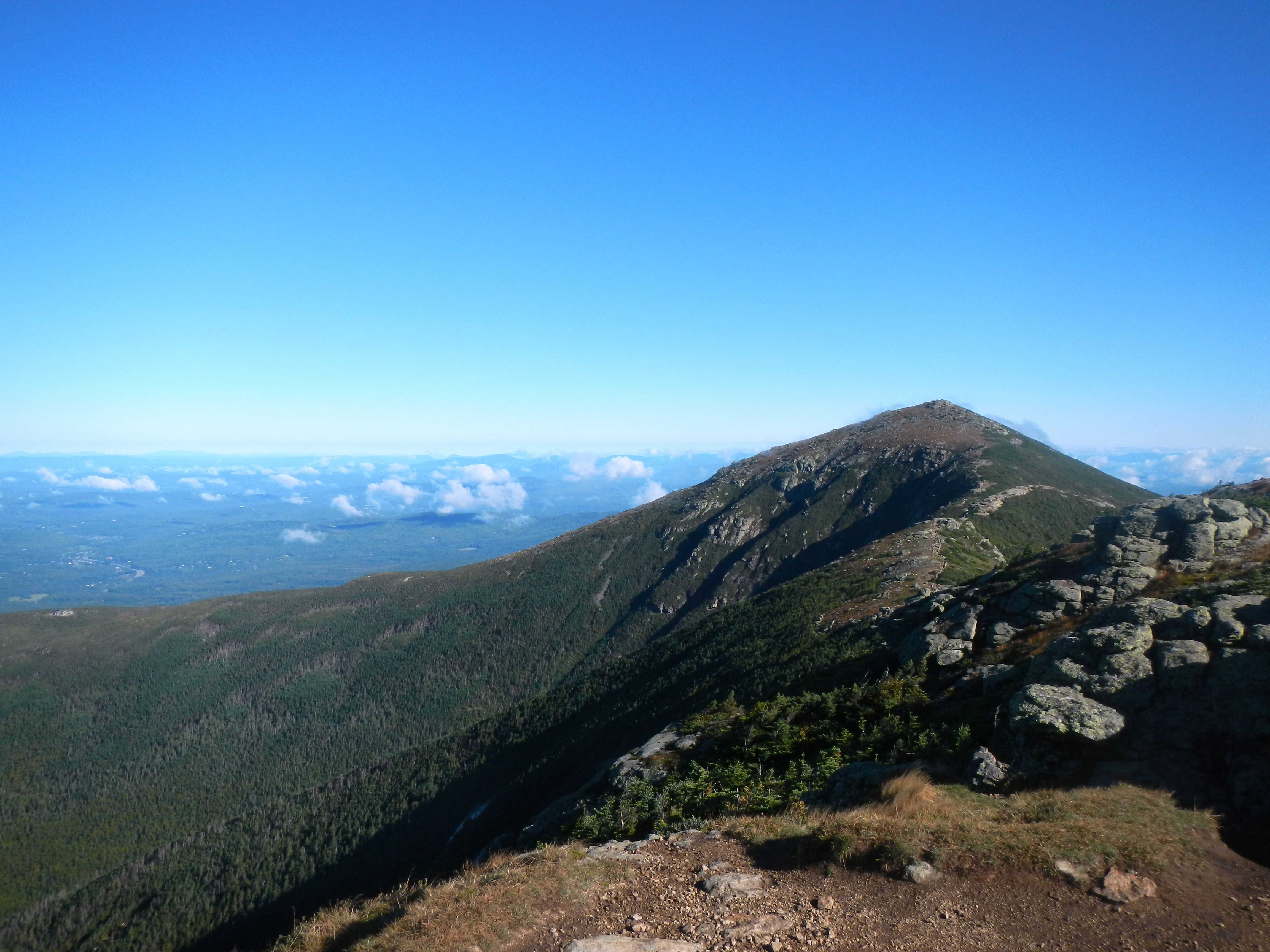
Hike 3: Mount Crawford (3,129′)
- Length: 5 miles
- Vertical: 2,100 feet
- Duration: 4.5 hours
A hidden gem. Mount Crawford is just down the road from the more popular hikes in Crawford Notch listed above, but sees just a fraction of the hikers. Crawford is slightly longer than Avalon, but less steep. Toward the top the trees start to thin and hikers enjoy a great view behind them toward Mount Carrigain and the Tripyramids. The summit — a small, rounded nub that is very recognizable from the road once you’ve done this hike — is mostly bedrock. You come around the final corner and are treated to a sweeping panorama of the southern Presidentials and of Crawford Notch:
It’s an incredible view for such a short hike. I highly recommend it.
- Directions: Parking for the Davis Path is just off Route 302 a few miles west of Bartlett, New Hampshire at a small lot on the right. Take the suspension bridge over the river to find the Davis Path.
Rating: ***
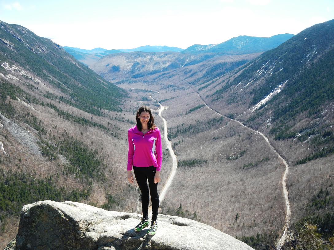
Hike 4: Lonesome Lake
- Length: 3.4 miles
- Vertical: 1,000 feet
- Duration: 2.5 hours
Another classic, short, easily accessible White Mountain hike. Parking for this at Lafayette Campground off Interstate 93 inside Franconia Notch. Lonesome Lake is anything but lonesome in the summer, but in the off-season is nice and quiet. It’s just over a mile from the campground parking area up and over the shallow ridge to the lake itself up on top. In the winter with no leaves on the trees, hikers can enjoy a great view of the Franconia Ridge behind them as they ascend the trail. Toward the top, the trail flattens out and soon the lake itself — often frozen at this time of year — comes into view. Because it’s not a long hike just to get to the lake, I recommend continuing on the trail all the way around the lake. Soon you’ll come to the AMC shelter on the far shore, from the deck of which there is a great view of the Franconia Ridge in the background:
- Directions: Park at the entrance for Lafayette Place campground, on the west side of the highway. As you turn into the lot, take an immediate left into the side lot on the south side of the facility. The trail is accessed here via a small bridge across the creek.
Rating: **
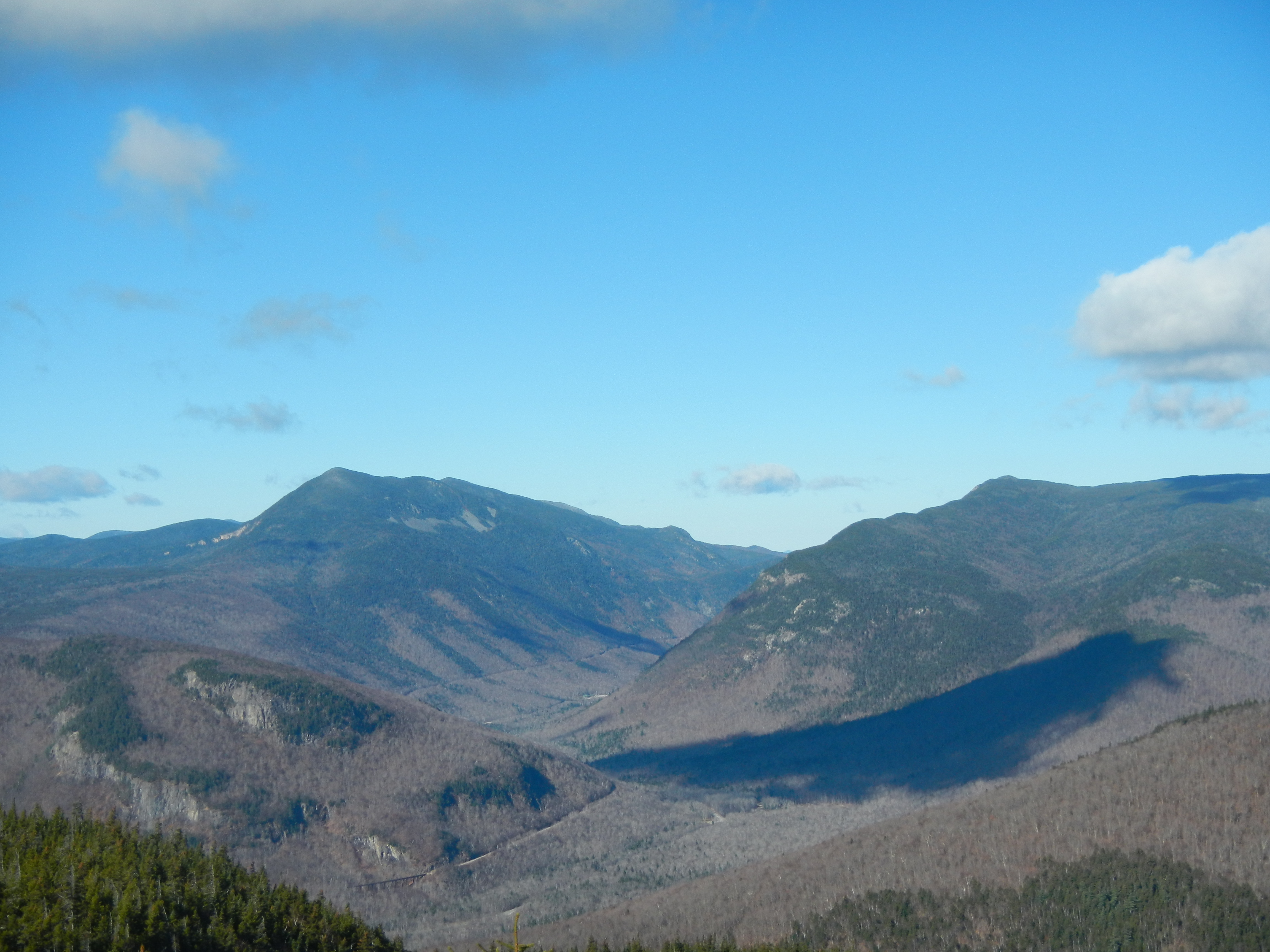
Hike 5: Bald Peak (2,470′)
- Length: 4.6 miles
- Vertical: 1,450 feet
- Duration: 2.5 hours
Almost directly on the opposite side of the ridge from Lonesome Lake is Bald Peak. Now, there are actually two Bald Peaks. One, which is called Bald Mountain, is almost directly at the base of Cannon Ski Resort and is a worthwhile hike on its own (albeit short — less than a mile). Bald Peak, on the other hand, is around the back of the Kinsman Ridge in the small town of Easton. Because it’s not in the Interstate 93 corridor, Bald Peak always gets a lot less traffic than Lonesome Lake. It’s more of a locals’ hike.
But no matter what, Bald Peak is one of the best short hikes in this part of the White Mountains. And to me, it’s a perfect off-season hike: it’s fairly short (2.3 miles to the top), but still long enough for a workout. The trail alternates between flat and moderately steep. There are several pretty brooks with little waterfalls on the way up (including a short side-hike to beautiful flume, up near the summit). And what a treat to emerge from the trees to find a completely tree-less rock summit with 360 degree views of Mount Moosilauke and Vermont:
I highly recommend this hike in the off-season — or at any time of the year.
- Directions: Drive south from the town of Franconia on Route 116. After crossing into the town of Easton and passing the Tamarack Tennis Camp, take an immediate left into a small lot marked with a hiker sign. The trailhead begins here.
- Rating: ***
Hike 6: Franconia Falls
- Length: 6.4 miles
- Vertical: 200 feet
- Duration: 2.5 hours
Less of a hike than a walk, this is a six-mile round-trip well spent. Begin at the parking lot at Lincoln Woods, the starting point for many a wilderness adventure in the Pemigewasset Wilderness. Cross the famous swinging bridge and walk the flat, well-graded Lincoln Woods Trail for three miles alongside the East Branch of the Pemigewasset River. Toward the end you’ll see a small trail lead left for a short distance along a small creek called Franconia Brook. A few minutes’ walk leads to a clearing at Franconia Falls, a small, picturesque waterfall on Franconia Brook.
This is a beautiful walk to take when strong winds make even the smaller mountain hikes like Bald Peak or Mt. Willard very cold. The river scenery along the Pemi River is gorgeous, and the trailhead is located just a few miles outside the town of Lincoln. Typically during the summer, you have to pay to park here, but during the winter it doesn’t really seem like you have to.
- Directions: Park at the large Lincoln Woods parking area a few miles east of Loon Ski Resort on Route 112. Take the swinging bridge across the river and follow the well-marked trail to the right.
Rating: *